Land Tool
Written By Philipp Brockerhoff
Last updated 18 minutes ago
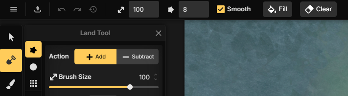
The Land Tool is used to create and edit the shape of the land on your map. It modifies the map’s Land Mask Layer, which defines where land exists. Use it to create continents, islands, coastlines, lakes, and other landmasses.
Select the Land Tool by clicking the Land Tool in the toolbar or with the M shortcut.
When the tool is selected, the last selected Land Shape Mask of a Land Brush Layer is automatically selected for editing. Learn more about how Land Layers and Land Masks work.
The Land Tool is available by default in the following scene styles:
Fantasy World
Fantasy Regional
Parchment World
Watercolor Cities
In battlemap scene styles, the Land Tool is hidden by default because these maps typically do not use Land Masks. If you add a Land Layer from the Layers Panel, the Land Tool automatically becomes available.
Add & Subtract Modes
Choose how the Land Tool modifies the Land Mask.
Add creates new land.
Subtract removes existing land.
Press X to quickly switch between the two modes.
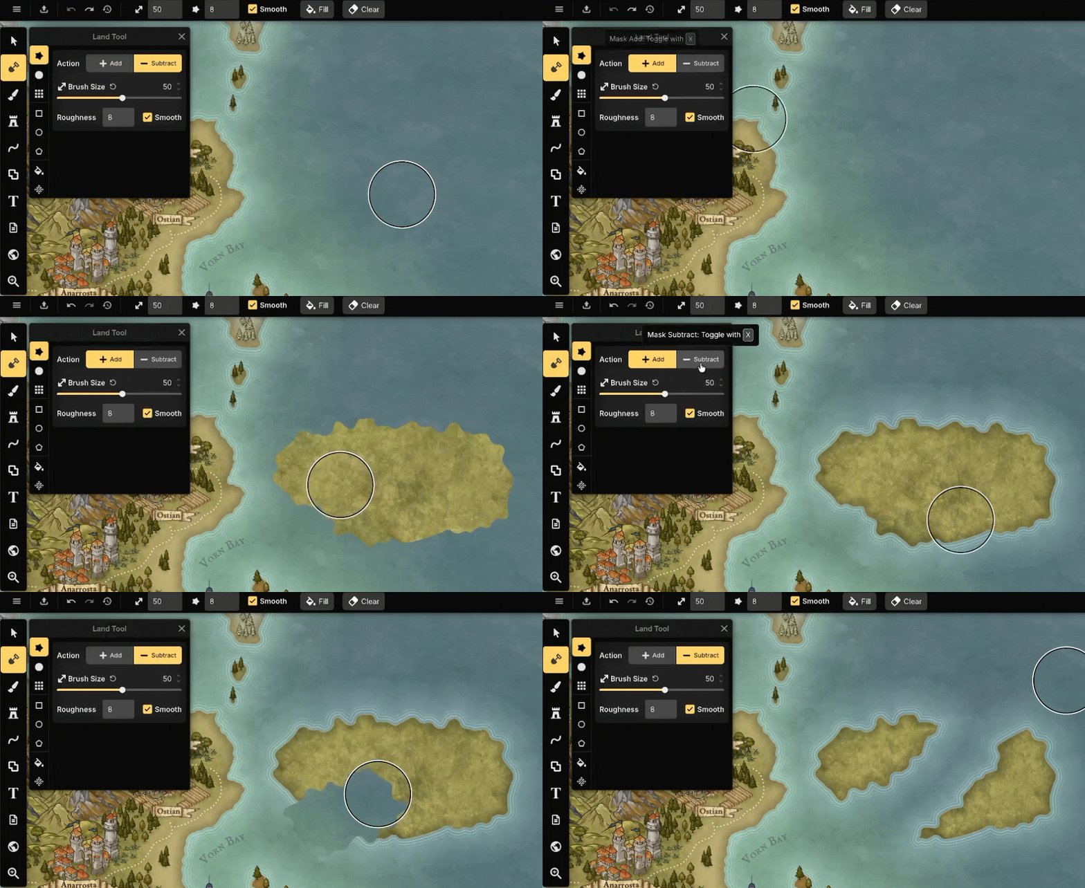
Brush Modes
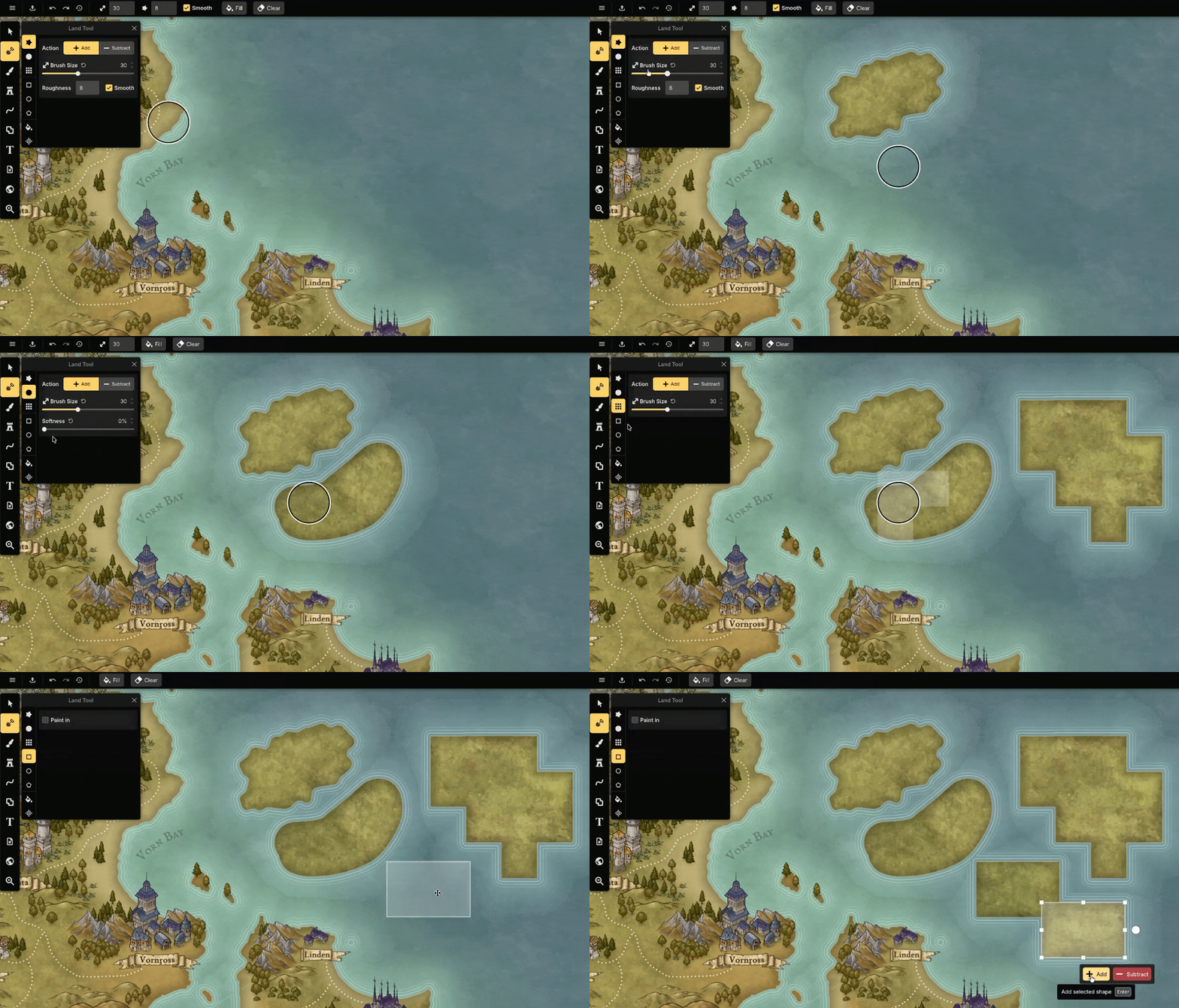
Brush Modes create or remove land as you click and drag across the map using the selected brush shape. Press W/S to adjust the brush size. Hold Shift to adjust it in increments of 10. The Land Tool offers the following brush modes:
Edge: Edge paints with a natural, irregular outline. This is useful for creating more organic land shapes. The Roughness setting controls the scale of the irregularities, from small details to large organic shapes.
Circle Brush: The Circle Brush paints with a clean edge as you drag across the map.
Grid Blocks: Grid Blocks paint using the active grid shape, making it easy to apply mask to individual grid cells.
Preset Shapes: Preview Modes let you define an area before applying a mask. The following shapes are available:
Rectangle: Fill a rectangular area.
Ellipse: Fill an elliptical area.
Polygon: Fill a regular polygon. The number of sides can be adjusted before applying the preview.
While creating or resizing using the Preset Shape mode, you can use modifier keys for more precise control:
Ctrl: Resize from the center instead of the initial corner.Alt: While creating a shape, constrains the selection to a 1:1 aspect ratio, creating perfect squares and circles. While resizing an existing preview, maintains the current aspect ratio.Ctrl + Alt: Combine both behaviors.
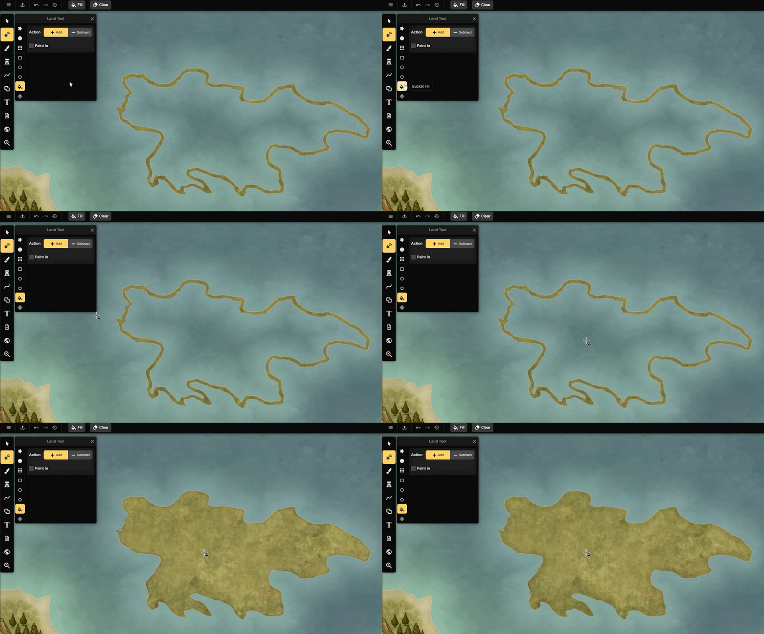
Bucket Fill
Bucket Fill fills a closed area with a single click. Use Add mode to create new land, or Subtract mode to remove existing land. The fill is limited by the surrounding land shape.
This is especially useful when tracing maps or filling large enclosed areas.
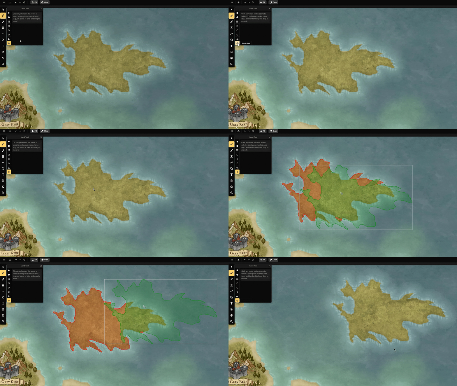
Move Area
Move Area lets you reposition a separate landmass or enclosed area without redrawing it. Click a landmass, island, or lake to select it, then drag it to a new location.
Paid Feature
The Move Area tool is available with a paid subscription.
Fill / Clear
Use Fill or Clear in the top toolbar to quickly fill or remove the Land Mask for the entire active Land Layer.
Tips
Start with a large brush to block out continents before refining the coastline.
Alternate between Add and Subtract mode to create bays, peninsulas, and more natural coastlines.
Alternate roughness levels to create more varied and realistic coastlines
For tracing a map, draw the outline and use Bucket Fill to quickly fill the continent.
Use the Ellipse Preset Shape together with
Altto create perfect circles.
See Also
Land Layers: Create and manage Land Layers.
Layers Panel: Create and manage Object Layers, control drawing order, and organize map content.
Brush Tool: Paint textures and colors onto Brush Layers.
Was this helpful?
Still need help? Ask the team